

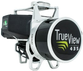
TrueView 435 3D Imaging System
Artikelnummer:
Ursprungligt pris
-
Ursprungligt pris
Ursprungligt pris
-
Aktuellt pris
Enhetsfrakt 225 SEK
Leveranstid ca 7-12 dagar på grund av flytt huvudlager
TrueView 435 är den mest ekonomiska plattformen för kartläggning av verktygskvalitet. GeoCues TrueView 435 är vårt nästa generations kompakta 3D-bildsystem som har den känslighet som krävs för kartläggning av infrastruktur. Dessutom gör dess överlägsna markfångstförmåga för lätt vegeterade områden detta till den mest ekonomiska plattformen för kartläggning av nyttograder.
| Specification | Value |
|---|---|
| Data Collection | LIDAR + Imagery |
| Laser Scanner | Hesai Pandar XT |
| LIDAR Beams/Returns | 16/2 |
| LIDAR Range | 80 m @ 20% reflectivity |
| Pulse Repetition Rate | 320 kHz |
| Cross-Track Field of View | 120 ° |
| Position and Orientation System (POS) | Applanix APX-15 |
| Accuracy | Better than 5 cm, RMSE |
| Precision | Better than 5 cm at 1 σ |
| Camera Sensor | 1’’ mechanical shutter, hardware mid-exposure pulse, 20 MP, RGB |
Sökord: