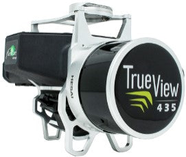
TrueView 435 3D Imaging System
SKU
Original price
-
Original price
Original price
-
Current price
Standard shipping
Approximately 7-10 days delivery time
TrueView 435 is the most economical platform for utility-grade mapping. GeoCue's TrueView 435 is our next-generation compact 3D imaging system that has the sensitivity required for infrastructure mapping. In addition, its superior ground capture capability for lightly vegetated areas makes it the most economical platform for utility-grade mapping.
| Specifications | Value |
|---|---|
| Data Collection | LIDAR + Imagery |
| Laser Scanner | Hesai Pandar XT |
| LIDAR Beams/Returns | 16/2 |
| LIDAR Range | 80 m @ 20% reflectivity |
| Pulse Repetition Rate | 320kHz |
| Cross-Track Field of View | 120° |
| Position and Orientation System (POS) | Applanix APX-15 |
| Accuracy | Better than 5 cm, RMSE |
| Precision | Better than 5 cm at 1 σ |
| Camera Sensor | 1'' mechanical shutter, hardware mid-exposure pulse, 20 MP, RGB |
Sökord: